Disclaimer

Saturday, August 31, 2013

Gold Hill Loop

Access: Gold Hill TH on the west side of HW 9 between Frisco and Breckenridge
Start: 1230, 8/24/2013
Total Distance: 9.58 mi
Duration: 1:23:30
Avg. Pace: 8:43
Lowest/Highest Elevation: 9,047'/10,331'
Weather: 65F/Partly Cloudy

The Route:
I run this from Farmers Korner, but ideally you would park at the Gold Hill Trailhead on the west side of HW 9.

From the parking lot, the route gradually climbs along a beetle kill deforested plateau, winding to a flat, still forested trail junction at a mile from the TH. Take a left to stay on the GHT, and start climbing again along single track.
Stay left
The top of the hill is reached after another mile.  Descend along single track, past a trail crossing. 
Continue straight

The GHT terminates at the Peaks Trail.
Turn right

Make a right onto the Peaks Trail and continue on a fast downhill for around 2 mi. 

Emerging from the Peaks Trailhead, make a right onto the dirt road. 
Turn right
Before the dirt road turns left, make a right onto a single track that parallels the paved rec path. If you cross the rec path, you've gone too far on the dirt road.
Turn right, staying left at the immediate fork
Follow the single track for about a mile, past the hospital. 
 At the split near the rec path, turn right to remain on the single track. 
Continue right
There is a short, steep climb that levels out and leads past wetlands on the right. Beyond the wetlands, there is another split*. Stay left proceeding down a short hill to the rec path. 
Continue left
Turn right on the rec path to return to the Gold Hill Trailhead in 2 mi.  
*Alternatively, you could make the right onto the logging road to stay on dirt trails leading back to the Gold Hill Trailhead as discussed in my previous post about Ophir Mtn.

Overall Impression:
Standard to Summit County, once beyond the deforested beetle kill, this becomes a shady tree run with intermittent views of the Tenmile Range. The climb is strenuous but not demoralizing. The long downhill from the top of Gold Hill to the end of the Peaks Trail is fast and technical. But try to keep your eyes up. I've run into moose right in the middle of the trail on two separate occasions. 

In autumn, the aspens along Peaks Trail reveal themselves.

It would be nice if there was no paved section at the end, though it's flat and manageable for a cool down.

The Run:

Friday, August 30, 2013

Haus Rock North Side

Access: Near Keystone. Unmarked parking lot on the north (left) side of Montezuma Rd 1.3 mi from US 6. Follow the trail and the cairns onward and upward from the parking lot. There is a left fork in the trail that is easy to miss. If missed, the trail leads to another, smaller bolted area called Hummingbird. Simply double back.
Difficulty: 5.6 to 5.10, slab climbs

The north side of Haus Rock offers 15 bolted sport routes. There is also a walk around for setting up top rope for some of the routes without leading.  Mountain Project offers detailed descriptions of each route. Arguably the best rock to be found in Summit County, the area is often crowded on summer weekends. The friendly folks of Summit County frequently share ropes enabling several different routes to be climbed consecutively on top rope. Just be aware of the varying degrees of experience, etiquette and safety amongst the climbers found here. 


Tracing the arete on 5.9 Lichen This

Your Correspondent on Lichen This


Climbers respectively on Lichen This, 5.8 Not So Hostile Krainzover, and 5.8 Feet Don't Fail Me Now

Your correspondent flailing up Feet Don't Fail Me Now


Monday, August 26, 2013

Ophir Mountain via Farmers Korner Bike Path

Access: Summit County High School
Start: 15:58, 8/20/2013
Total Distance: 4.11 mi
Duration:  0:36:11
Avg. Pace: 8:49
Lowest/Highest Elevation:  9064'/9977'
Weather: 65F, overcast


The Route:
There is an entire network of single track, dirt roads, and game trails in the hills behind Summit High extending north to south between Iron Springs and the Colorado Trail at Gold Hill and bordered to the west by the Peaks Trail. This particular route starts on the rec bike path adjacent the high school. On the northwest side of the school, a narrow single track splits off left from the bike path in a spot where the bike path intersects with a perpendicular bike path leading to HW 9.

The trail climbs 300' in under a quarter of a mile to an old dirt logging road. Take a left on the logging road and continue climbing for about 150 yds. Near the top of the logging road, there is a steep trail that splits off to the right. If you start running downhill on the log road, you've gone too far. The steep narrow trail ascends 600' south through thick trees paralleling the rec path below. In a few clearings, there is a good view of Summit High and Farmers Korner below. The trail levels out at around 10,000' near Ophir Mountain's peak. Continue on to the T in the trail. Taking a left, the trail quickly wraps around to another split. Staying left, the single track descends about a mile where it turns into a double track.

Follow the double track until the double track makes a hard right. There you can hop off the double track and continue straight on a single track that leads to the Farmers Korner houses on the hill. The single track cuts left behind the hill houses and you can turn off right anywhere along the single track to hop on the paved road below that leads back to the paved rec path. Alternatively, you can remain on the double track. This leads you further south to a system of roads and trails in the Gold Hill area near the Colorado Trail.

Overall Impression:
The trails around Ophir Mountain do not see much traffic. They're a viable alternative to the overcrowded Peaks Trail on the opposite side of Ophir. In a county that has a lot of disappearing forests, the trails around Ophir are still thickly wooded. It is easy to get lost if you are unfamiliar with the trails, but if you have a grasp of the area - there are more variations than the Oregon Ducks football team's uniforms.

The Run:
http://runkeeper.com/user/bwayne/activity/229783654

Saturday, August 24, 2013

Berthoud Pass Skiing

Winter 2012/2013
Location: Continental Divide along US 40 North of I-70 on the border of Clear Creek and Grand Counties
Base Elevation: 11,307'
Average Annual Snowfall: 390"
Vertical Rise: 1530'
Skiable Terrain: 1200 acres+ 
Difficulty: Green to Double Black
Access: Ample parking is available at the top of the pass, where there is also a cozy warming hut. 


Old Trail Map

Oatmeal Bowl and No Name Peak
North Chutes


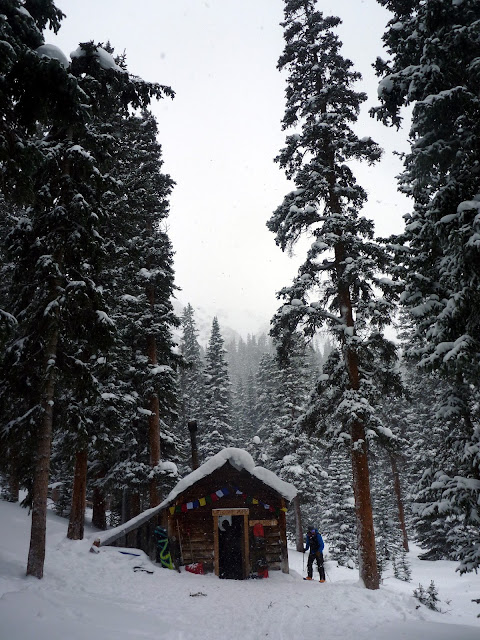
Peter Rabbit Cabin


More info: 
http://grandlin.es/zones/berthoud-pass/
http://berthoudpass.com/index.cfm/index.cfm

Thursday, August 22, 2013

Eccles Pass via Meadow Creek TH

Access:  The Meadow Creek Trailhead on the north side of I-70 off Frisco/Breckenridge Exit 203
Start: 1004, 8/20/2013
Total Distance: 14.14 mi
Duration: 3:01:01
Avg. Pace: 12:48 
Lowest/Highest Elevation: 9,186'/11,900'
Weather: 65F/Mostly Sunny
The Route


The Route (mileage from the start in parentheses):
The Eccless Pass loop around Buffalo Mountain is located at the southern end of the Gore Range in Summit County. I opted to run it counter clockwise. It is primarily single track. Ascending steeply from Meadow Creek, the trail levels off and forks at 0.5 mi. Take the right onto the Lily Pad Lake Trail up to the unremarkable Lily Pad Lake (1.5 mi), where the trail continues north.

Looking back on Dillon Reservoir from the Lily Pad Lake Trail
Stay left on the main trail leading to a paved neighborhood road called Ryan Gulch Circle (3 mi). Descend the road to the Buffalo Cabin Trailhead. Continue 1 mi on Buffalo Cabin Trail until the trail splits. Continue straight onto South Willow Creek Trail. DO NOT turn left, as the remainder of the Buffalo Cabin Trail leads up Buffalo Mountain. The South Willow Creek Trail quickly deteriorates into a narrow descent over steep rocks. Some route finding is required here. After 0.25 to 0.5 mi of descending, the trail widens and flattens out leading to a few small stream crossings over logs. After the stream crossings, the trail merges with the Gore Range Trail, turning left (5 mi). Continue a little under a mile, where the South Willow Creek Trail splits from the CDT. The South Willow Creek Trail is a short detour to a waterfall. 

Willow Creek Falls
 Continuing right at the split to stay on the GRT, the trail starts to climb in earnest over the next 3 mi through rocky single track in alpine meadows, thick brush, and tight trees in the shadow of the north face of Buffalo. This is the most difficult, most desolate and arguably prettiest section of the loop. 

Looking North from the Gore Range Trail
Around 8 mi in, treeline is reached and the trail splits (unmarked) between the Gore Range/Eccles Pass Trail and the Red-Buffalo Pass Trail. 

At Tree Line
Stay leftish to Eccles Pass unless you want to go over Red-Buffalo Pass down to East Vail.  After another mile of climbing, Eccles Pass is reached (9 mi). 

Looking North to Red Peak from Eccles Pass
 Continuing down from Eccles Pass on the Gore Range Trail, the trail again splits (marked). 

Split of Meadow Creek and Gore Range Trails
Stay left on the Meadow Creek Trail. The next 5 mi follow the wider, more popular Meadow Creek Trail back down to the Meadow Creek Trailhead.

Overall Impression:
This is mostly a secluded scenic route through alpine meadows and lakes. The beginning near Lily Pad lake is littered with beetle kill, but the South Willow Creek section of the trail all the way up to Eccles Pass is aesthetic and completely desolate - thick forests of Aspen, Douglas Fir and Ponderosa, peppered with small streams and open meadows. I recommend the detour to the South Willow Creek Falls if not in a rush. It's a beautiful spot to re-energize before the big climb up the Gore Range Trail to the top of Eccles Pass. The 5 mi descent from Eccles Pass is fast and steap. If you charge it, you'll feel it on your quads by the bottom.

The Run:
http://runkeeper.com/user/bwayne/activity/228557662