Disclaimer

Showing posts with label Skiing/Riding. Show all posts

Sunday, January 4, 2015

Cadillac (Tiptop Peak)

Access: Montezuma (summer road 264)
Start: 1000, 1/4/2015
Total Distance ~3.5 mi R/T with a car shuttle from the Peru Creek TH
Duration: 3 hours
Vertical: ~1700'
Aspect: N
Weather: 20F/mostly cloudy, 30 mph NW gusts above TL
Conditions: powder

Tiptop Peak is a low 12000' peak just north of the booming metropolis of Montezuma in Summit County. Cadillac is a north facing avalanche path that runs into the Peru Creek drainage.

The Approach:
The skin track generally follows a summer road that switchbacks on the SW ridge.   At tree line, leave the summer road and cut across the western flank of Tiptop to the first avalanche path facing north with views of Lenawee (i.e. backside of A Basin), Grays, Torreys and Grizzly Peaks across the Peru Creek drainage.
Looking south with Santa Fe Peak in the background
The Line:
There are a few different options to drop into the path. If the avalanche hazard is considerable it's advisable to avoid the above tree line northern face of Tiptop, as it has a 35+ degree pitch that flushes into Cadillac. The skier's left, western edge of the slide path is a safer option to avoid undercutting the section that is more prone to sliding. An alternative is to skin above the steep section and drop in skier's right. This side of the gully has thicker trees.
Top of Cadillac looking north with Lenawee, Grizzly, Torreys and Grays Peaks across the Peru Creek drainage

Regardless of entry point, the terrain naturally funnels into the gully below tree line with sparse young trees scarred by flagging.


The incline is a consistent 30 to 35 degrees until the bottom of the line where the trees thicken and the gully flattens. Skier's left through the thick section leads to a sub-gully with sparse trees and a slope of similar incline - this gully descends to the valley floor and the Peru Creek Trail.

The exit is west along the well-traveled Peru Creek Trail for ~1 mi to the Peru Creek TH where you should have your shuttle parked.

Although Cadillac can and does slide, it is not as likely to avalanche as some of the other lines in the area (e.g. Corkscrew). With careful consideration of conditions, it offers a reasonably safe option for mid-winter skiing.

Monday, May 5, 2014

Prom Dress Couloir (Peak 1)

Access: Mt. Royal TH or the bike path in Frisco
Start: 0900, 5/2/2014
Total Distance ~6 mi R/T
Duration: 4 to 5 hours
Vertical: ~2000'
Aspect: NE
Weather: 30F-45F/clear, 10-20 mph winds above TL
Conditions: Wind compacted powder, corn

Peak 1 is the northernmost peak in the Tenmile Range rising prominently to the south of I-70 with Frisco in its shadow - especially in the winter when the sun sets at 1 PM over the western edge of town. The snowy summit stares at me every morning from my front porch so I've been itching to drop the Prom Dress for awhile. Save it for stable conditions with ~45° slopes crossing over cliffs and funneling into a 35° bowl.

The Approach:
There are really two choices. There's the obvious route from the Mt Royal TH that climbs past J-chute over Mt. Victoria with class 3 scrambling on the NE ridge to the summit. The summit often has a cornice that must be navigated to reach the east ridge and the entrance to Prom Dress. The traverse from the summit to the east ridge lies above 200' cliffs.
The other option is to skin from the bike path directly to the east ridge. The bike path option requires careful route finding as the summit is obscured by thick trees most of the way and there are several sub-ridges that can leave you removed from your destination.
Once you reach TL, gain the east ridge and proceed to the entrance on the looker's right of the ridge.
Tenmile Peak to the left
There are several line options along the ridge. Prom Dress is the upper most, roughly 3/4 of the way to the summit.

The Line:
Prom Dress Couloir has a 20' wide entrance. There is a vertical cliff band in front of a cornice of variable size with the entry of the line descending between the cornice and the cliff band.

Skier's right of the cornice is a second cliff band. The couloir extends for a couple hundred yards between the two cliff bands.
Dillon Lake in the distance 
The entrance to the couloir is around 40° and tops out around 45° in the middle. The bottom funnels into the 35° NE bowl of Peak 1.
From the middle of the NE bowl looking up on Prom Dress
The exit is through the trees at the base of the bowl back to Frisco. Route finding is key.
Below TL looking back on Peak 1

Sunday, April 13, 2014

Elvis's Crotch Couloir (Buffalo Mountain)

Access: Ryan Gulch TH above Wildernest in Silverthorne
Start: 0800, 4/11/2014
Total Distance ~5 mi R/T
Duration: 4 to 5 hours
Vertical: ~2500'
Aspect: North
Weather: 30F-45F/clear, 10-20 mph winds above TL
Conditions: from high to low - hard pow, soft pow, corn, slush

Silver Couloir is one of the lines in 50 Classic Ski Descents of North America By Chris Davenport et al. Little Elvis Couloir is the line skiers right of Silver. And Elvis's Crotch is the rarely ridden, narrow deep cut couloir that bridges the rocky ridge between the top of Little Elvis and the bottom of Silver. It is best to ski it in soft stable spring conditions, as an avalanche or fall on this line would be high consequence.

The Approach:
From Ryan Gulch TH, proceed to the first marked trail intersection and turn left up the Buffalo Cabin trail. Continue through the trees to TL, gaining the ridge between the glacial cirque in Buffalo and the northern summit.
Glacial Cirque with Tenmile Range in the background

Topo credit: the late George Dirth, http://grandlin.es
The top of Little Elvis is 100 to 200 yd before the first/southern access to Silver. Upon entry to Little Elvis, the entrance to Elvis's Crotch is guarded by a jagged rock pinnacle skier's left ~100' down.

Rock Pinnacle at top of Elvis's Crotch
Elvis's Crotch entrance is 45º sustained into a narrow choke that approaches 50º.

Choke at the top of the photo
The rest of the line is 40-45º with another narrow choke before the entrance to the bottom of wide open Silver. The chokes vary in width considerably with the snowpack. On this day, both the top and bottom chokes were little more than 2 yds across.

Approaching bottom choke
Beneath bottom choke
Looking down on Silver proper
Bottom 1/3 of Silver proper
The exit of Silver is skier's right into the trees along an aqueduct at the base of Silver above the Gore Range Trail. Exiting Silver can be a pleasant skin along an established skin track or a grueling bootpack over deadfall with ample route finding. After only a couple hundred feet along the aqueduct is the right turnoff onto the moderately steep uphill Buffalo-Willow Connect. It is not uncommon to miss the right turn and continue along the Gore Range Trail adding unnecessary miles to your trip. The Buffalo-Willow Connect will lead directly back to the Ryan Gulch TH.


Saturday, August 24, 2013

Berthoud Pass Skiing

Winter 2012/2013
Location: Continental Divide along US 40 North of I-70 on the border of Clear Creek and Grand Counties
Base Elevation: 11,307'
Average Annual Snowfall: 390"
Vertical Rise: 1530'
Skiable Terrain: 1200 acres+ 
Difficulty: Green to Double Black
Access: Ample parking is available at the top of the pass, where there is also a cozy warming hut. 


Old Trail Map

Oatmeal Bowl and No Name Peak
North Chutes


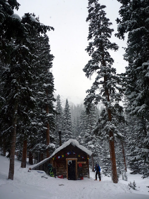
Peter Rabbit Cabin


More info: 
http://grandlin.es/zones/berthoud-pass/
http://berthoudpass.com/index.cfm/index.cfm