Disclaimer

Saturday, November 19, 2016

Pilot Mountain to Hanging Rock (PM2HR) 50K

 
Location: Danbury, NC; Pilot Mountain SP to Hanging Rock SP via the Sauratown Trail
Date Run: 10/15/2016, 0730 start
Duration: 4:21:21
Place: 1 out of 126
Average Pace: 8:24
Elevation: 750' to 2050'
Weather: 50-70F, clear
Race Website: http://pm2hrultras.com/

About a two hour drive north of Charlotte, 12 miles south of the border with Virginia roughly halfway between nowhere and someplace is a little town called Danbury. It would be unremarkable were it not in the shadow of two impressive state parks - Hanging Rock and Pilot Mountain. Both have rapids on the Dan River, multipitch sport and trad climbing, and an impressive trail network connected between the parks by the Sauratown Trail.
I stumbled upon the race website while perusing runningintheusa.com. It had a couple main draws. 
Of the dozens of race formats I've done, my preferences go:
  1. Point to point (Imogene Pass Run in CO)
  2. Loop (Breck Crest in CO)
  3. Out and back (Cloudsplitter in KY)
  4. Repeating sections (I avoid these)
PM2HR is a point to point between state parks and it looked scenic based on the cherry picked photos from the website. In person it equally really impressed. Pilot Mountain rises slowly from the valley like most other Appalachia humps but the top is capped by an almost perfectly cylindrical shear rock wall. Hanging Rock has beautiful waterfalls in the valley floor of the park, while 1500 feet above and a 2 mi hike away are shear cliffs with unobstructed views of the surrounding countryside.
I met my college friend Aaron in Danbury the night before the race. We stayed at a cozy 2 bedroom called the Wren Roost in the Whippoorwill Inn. There was no front desk, didn't see the owners once the entire weekend; but there was key underneath the doormat and the place was clean. The town really had limited dining options. I was thrilled to find hot cheetos and takis at the corner market but would have preferred a banana. The River Rock Cafe on the outskirts of town had a decent pasta dish adequate for a pre-race meal.
The race was a point to point from ::drumroll:: Pilot Mountain to Hanging Rock, so for $10 a bus shuttled runners from the finish to the start. Within five minutes of departing HR at 0630, our bus was pulled over. Turns out the driver, in addition to not signaling, was also going the wrong way so the officer kindly escorted us to the start. Despite it being 0715, dawn had yet to arrive. There were only two urinals available for the 135 50k runners. Usually I try to take care of business before arriving at the start but the coffee failed me so I was resigned to waiting in the dark line for half an hour. The rising sun moved in sync with the line illuminating Pilot Mountain in the distance. 
After a brief pre-race meeting lamenting the closure of portions of the Sauratown Trail and reroutes on pavement, the gun went off at 0745. The 50k started in Pilot Mountain, but only the 50 milers actually ran in the park. The 50k just skirted the edge of the park quickly jumping on the Sauratown on a fast descent leading out of PM. Four of us charged down the wide trail going sub 7:00 for the first mile. Once the trail flattened so did the pace. The pack dispersed and after the first four miles I was alone in the front where I remained through the finish.
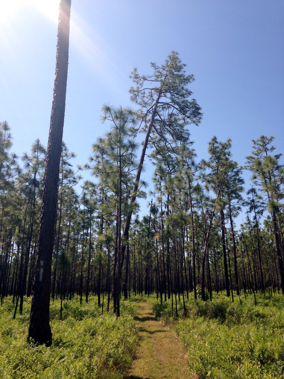
Sauratown Trail was primarily rolling technical single track with one significant climb starting at mile 10. The trail had a lot of flow to it but also had infrequent road crossings and portions that ran along the road. It was less than optimal but unavoidable because of trail closures. Mile 17 through mile 20 just before entering HR Park consisted of a long climb along the road. The pavement was warm and draining.
There was an aid station before leaving the road and entering the HR trail system but I didn't take in enough electrolytes. After the 1000' climb from the road to the race's highest point in HR, I was left with an electrolyte imbalance. On the rapid technical descent from Moore's Wall, I took a digger on the technical downhill and both of my hamstrings locked. One of the race organizers marking the trail climbed toward me from the opposite direction but hadn't seen me go down. After telling me I was crushing it from a distance he broke mid sentence asking "Uhhh... doing okay?" Guess I looked off balance and shaken - the blood dripping down my leg might've been a clue too. He quickly rifled through his pack leaving me with pretzels and a bottle of water on the fly. 

His gesture really saved my race. There wasn't another aid station for 3 more miles of steep quad crushing downhill that transitioned from single track to crowded concrete walkway. My handheld was drained and I was running on fumes by the time I rolled into the aid station at the parking lot of the HR visitor center. I had a PB&J, drank half a liter of water, and for the first time in my life, I downed a salt tablet. It actually worked and the intermittent cramping in my hamstrings eased. The aid station volunteers informed me I was out front by 20 mins. I relaxed my pace some as I descended further through HR. 

The trail from the visitor center gave way to steep stairs that navigated through beautiful waterfalls near the floor of the park. In light of my lead, I decided I wanted a picture taken in front of the falls. I failed to bring my phone so I asked a random park visitor for assistance. The man hesitantly admitted to having a phone. After I explained I was running a race and didn't want to miss the chance to take a picture in front of the falls he quickly acquiesced. I passed off my phone number on the fly and continued down the stairs to the base of the falls.
Knowing I was about 26 miles in, I conserved energy through the flats to avoid a late race bonk. An abundance of stream crossings peppered with picturesque fallen autumn leaves kept my pace in check. When the course finally emerged from the underbrush of Hanging Rock onto a gravel road, my GPS put me at 29 mi. The course ended rather abruptly a half mile later 1.5mi short of 31. I crossed the line in 4:21, first overall. The next finisher came through in 4:55 so I was alone with the volunteers for awhile. I grabbed the free finisher beer and hobbled down to the Dan River adjacent to the finish line. There was a raft put-in providing a convenient spot to hop in and soak my legs. As more runners finished, the riverside bar at the finish line provided the perfect spot to unwind and hang out. My buddy Aaron finished in the front end of the pack in around 6 hours. Wasting no time, we grabbed more beers and got back in the river making a perfect end to a great race.

Ratings
Race Organization (5=phenomenal, 1=atrocious): 4/5
The good: Well marked, plenty of food at aid stations, diverse beautiful course with a great finisher area.
The bad: Did I mention the shuttle driver was pulled over on the way to the start?

Course Difficulty (5=Pikes Peak Ascent, 1=a flat dirt road): 3/5
I took a digger. I never take diggers. The technical downhill sections were fast requiring focus. Though the road sections - not so much. The climbing was moderately challenging but not demoralizing.

Course Scenery (5=engagement proposal backdrop, 1=concrete walls): 4/5
A point to point in the fall with plenty of elevation changes and a diversity of terrain I rarely see in the east.

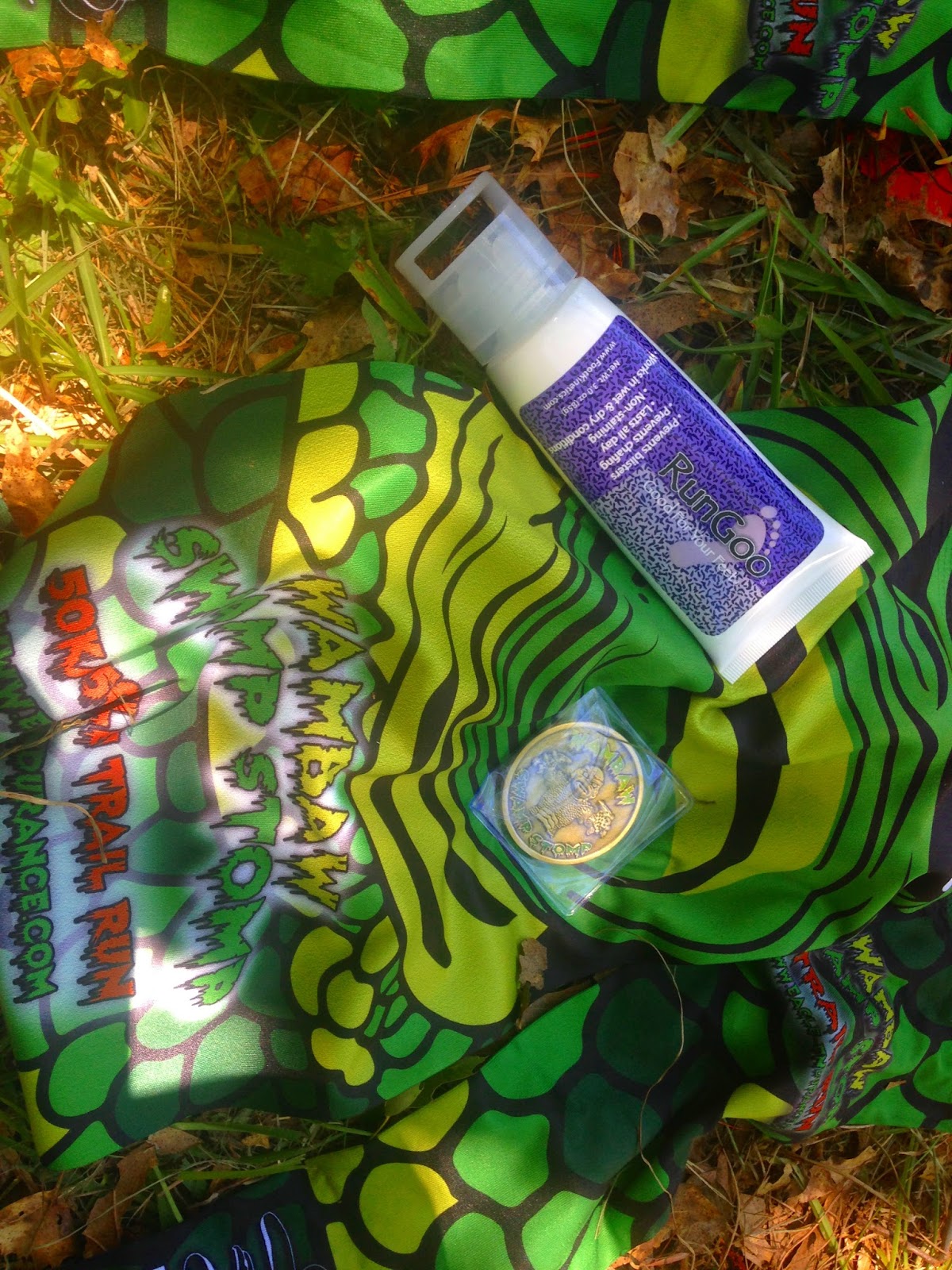
Schwag (5=a tech T, embroidered towel & warmup pants, 1=a cotton shirt): 4/5
Unique finisher medal, framed plaque for winning, free finisher beer, and a sweatshirt

Overall: 5/5
The brief road sections and bathroom line at the start were the only drawbacks of this race. Even getting pulled over provided quality conversation fodder. Courses like this are why I love trail running.

Monday, October 10, 2016

The Crestone Traverse (Peak to Needle)

Access: South Colony Lakes
Start: 0700, 7/9/2016
Climb Rating: 4+
Duration: 4:30 Crestone Peak from SCL
                3:30 Peak to Needle Traverse
                6:00 Needle Descent (wrong couloir with retrace)
Total Distance: ~6 mi R/T
Vertical: ~3500' (not including the 600' regained from the wrong descent)
Summit: Peak 14,294', Needle 14,197'
Weather: 50-70F/bluebird
Nearest Town: Westcliffe, CO
Dawn on Broken Hand Pass and Crestone Needle from South Colony
Jutting out from the rest of Colorado's mountain ranges like a severed appendage dangling is the Sangre de Cristo Range. Fitting, as "Sangre de Cristos" is Blood of Christ in Spanish. The narrow 75 mile long range rises 6000+ feet above the San Luis Valley on the west and the Arkansas River watershed to the east.
The Needle and Peak from Humboldt
Near the northern terminus of the range is the Crestone Group of peaks lying in the Sangre de Cristo Wilderness that include in addition to the Needle and Peak - Humboldt, Kit Carson and Challenger. In the last few years the South Colony trailhead on the eastern side of the peaks was moved a couple miles further down valley requiring a more serious commitment for access to two of the more imposing 14ers. Four of us - Splinter, Birddog, Stryker and myself - set out to behold these majestic peaks for ourselves. After a long hike into the South Colony Lakes campground with 50 lb packs, we were greeted by the most human habituated big horn sheep I've ever encountered. They used our latrine location 50 ft from camp as a salt lick.

Having made camp by 1600, we decided to knock out Humboldt as an acclimation hike. Despite making short work of the walk-up 14er we were passed near the summit by a swift solo hiker. As he passed I commented, "warmup for the Crestones?" and he just ignored me so I immediately prejudged him as a pompous jackwagon. Upon summiting I came to realize the bat out of hell was deaf. I was the asshole. After communicating via notepad on the iphone, we became acquainted with Kevin and agreed he'd join us for the traverse the following day.

THE CLIMB TO BROKEN HAND PASS

Setting off at 0630 the following morning as the sun was just splashing the top of the Needle, the five of us made a dark approach to Broken Hand Pass and encountered significant (though low angle and soft) snow crossings less than a mile into the climb. This made the steep approach to Broken hand more technical than expected. There was a tricky move required to climb off the snowfield onto the steep hanging scree garden beneath the pass. A slip here could have been consequential and we had yet to even start up either of the peaks.

CRESTONE PEAK VIA SOUTHEAST/RED GULLY

We decided to do the traverse Peak to Needle to enjoy the airy headwall scramble up the Needle and to further avoid any planned rappels. The descent from the pass down to Cottonwood Lake was quick and dirty on a loose trail. From Cottonwood Lake, the start of the Peak ascent is fairly obvious, winding around the base of the Needle along an established trail and up the lookers right flank of the Peak. However, the trail terminated at heavy spring runoff requiring some route finding around the wet rock and into the red (SE) gully. Despite a warm early summer and a SE exposure, the red gully still had a lot of snow.

Splinter, Birddog and Stryker climbing the Red Gully
Our party had 2 switchovers between crampons/ice axes and scrambling. It wasn't until we reached the top of the red gully that we could remove the crampons. I'd estimate there was at least 1500' vert of snow climbing up the red gully. We received reports that several parties were confident they could summit without crampons and ice axes, only to be turned around halfway up the gully. THIS CLIMB SHOULD NOT BE ATTEMPTED WITHOUT HELMETS, ICE AXES & CRAMPONS in early-mid July. Although the transitions to crampons added considerable time, we had little concern of potential rockfall. If you're comfortable, I'd recommend this climb with snow. The climb offered stunning views of Great Sand Dunes National Park in the distance.

After exiting the red gully, the climb up to the summit is a steep class 3 scramble over large blocks. Careful route finding got us there in about 15 minutes.

Crestone Peak Summit
 THE TRAVERSE TO CRESTONE NEEDLE


Here the climb became interpretive and sporty. After summiting with the standard route and starting the descent the same way, the exit from the gully to start the traverse is around 350' down the red gully. It was relatively well marked with a giant cairn, but when focused on a steep snow climb it is easy to miss. Luckily, Kevin -great addition to our team- was more observant than the rest of us and spotted the cairn during the ascent. All of us were surprised by just HOW FAR we had descended prior to arriving at the established start point. If started too high there is a strong likelihood one will be turned around, cliffed out or otherwise screwed.

Descending the red gully to the start of the traverse
The start of the traverse landed us on a large flat slab. It's not obvious if the route trends up, down, or straight across. Careful observation spotted the occasional cairn guiding the route but they were sporadic and largely absent when we needed them most. I strongly suggest printing out the 14ers.com guide to the traverse - in large, vivid photos that you can leaf through unless you want to take an ipad. Repeatedly we found ourselves making blind route finding decisions.

The first half of the traverse is generally class 2+ terrain losing elevation through the course of a few descents and ascents. We had to keep a disciplined eye out for the cairns as it was tempting to traverse too high. Eventually, after we didn't think we could possibly be on the correct route despite the cairns because we had lost so much elevation, we found ourselves on a distinct rock rib regaining elevation. We traced the rib following cairns upwards about 100' of elevation until we reached a prominent red gully that looked more inviting than a hammock. Two of our group gained about 200' in the gully only to realize the correct route was up a steeper less demarcated chute that lied across and down from the more obvious looking red gully. A hard look at the route directions from 14ers.com corrected the error.

Navigating one of the ribs
The faint chute leads to the top of the right flank of the red gully. We did not encounter any cairns leading up to or within this faint gully - though we built some of our own. From the top of the chute on the rib, there is another, steeper, gully flanked climbers right by some slabs. That gully led us upward to the top of another rib. A gentle climb down cleared the rib and we could first put eyes on the black gendarme.

The approach to the black gendarme
There are two standard routes from here to gain the headwall. One traverses straight out onto the exposed class 3+ slab lying below the headwall. The other follows a talus ramp below and around the base of the black gendarme. We opted for the latter route. A straightforward and unexposed walk on ramps leads to the right side of the black gendarme to a narrow gully entrance. The entrance is obstructed by a set of large boulders jammed between the walls of the gully. This is the only class 5 move but it's completely unexposed. In prior trip reports, a fixed rope was shown anchored at the move for assistance if desired. We saw no sign of the rope. With a stem between the gully walls, we all navigated the move with minimal effort - having some height helped.


Beyond the jam, the steep narrow gully led us to the ridge proper. Upper South Colony Lake could be seen a couple thousand feet below. The exposure was dizzying. A solid, short rock fin cutback from the top of the gully. The fin had a 25' drop on the climbers right side, and a 2500' drop on the climbers left side. We carefully straddled the fin and bridged the 10' gap to gain the grassy ledge above.

The Fin - upper South Colony Lake below
The "Z-ledges" brought somewhat difficult route finding. At the top of the first, we cutback left toward the ridge proper climbing to a dead end with nothing but a sheer drop below and a sheer wall above.  Backtracking, we realized the correct route was around the gully we had climbed in error and up an adjacent gully. The Z-ledges were a series of steep gullies that abruptly terminated at an open balcony at the base of the headwall.

Kevin cresting the headwall
The headwall is imposing. The climbing difficulty decreased from climbers right to left, but the exposure also increased considerably. The leftmost option was on the spine of the ridge with 2500' of nothing below. We all opted for the easier climbing, more exposed option, realizing a fall anywhere on the headwall would be catastrophic.

Needle Headwall
 I had packed a 30m, 8mm rope, a light rack and climbing shoes in case the climb was beyond our comfort level. We all felt the provisions unnecessary and meticulously tackled the airy wall unroped in our boots. It's a short 100' section of class 4 with mostly solid knobs. Double checking every hold was a must as I encountered loose rocks twice. The slope angle mellowed out in the last 20' just before we passed a bolted rappel station and topped out on the Needle.


NEEDLE DESCENT VIA STANDARD ROUTE (EAST/WEST GULLY)

We found ourselves alone on the summit until our descent. A climbing party of two arriving just as we were leaving had come up the east gully having missed the crossover to the west gully. They advised us to follow the west gully down. We had all read beta on the Needle's standard route; this feedback reinforcing what we already knew. Our successful completion of the traverse left us complacent. We foolishly assumed there were only two obvious gullies off the summit, the east one we observed the party coming up, and the west one next to the east gully.

With a bit of overconfidence, we started down the wide open gully before us. Despite not encountering a cairn or any sign of other climbers, we continued on. At one point about 600' down the gully, we noticed there was no clear crossover and the terrain in the gully had grown too steep to continue on without a rappel. We finally questioned the accuracy of our descent route. But above us, the climbing party we had encountered on the summit was following us in lockstep. They were completely confident we were in the "west gully".

Stryker and Splinter forged ahead along the perimeter of the gully searching for the crossover to the west gully. They landed atop an exposed 60' high rib with a difficult climb. A downclimb was impossible, and I was carrying the rope needed for a rappel. At this point, the three of us remaining in the gully behind and beneath the rib decided to turn around. It was a difficult decision to willfully split up, but none of us felt comfortable climbing up to the top of the rib without knowing where it would lead.

Observing our difficulties from above, the other party had already turned around as we slowly followed. The day was growing long and our energy stores were completely sapped. Regaining the 600' left us drained. By the time we had emerged from the gully to just below the summit the other party ahead of us had resummited and we all remained completely vexed on the correct route down. We encountered another party of two who had just summited from the technical Ellingwood Arete route. They were also unfamiliar with the descent so they heeded our cautionary tale. We all carefully studied a topo and the large, glossy photos of the route the technical climbers had printed out. It became apparent the gully we had mistakenly descended was one of several gullies that fanned out from the initial descent off the summit. The west gully closely traced the east gully on a parallel SSE fall line. We had descended a SSW facing gully that bottomed out above some cliffs and Cottonwood Lake.

Our three parties made our way down the standard route together with few difficulties. The crossover from the west to east gullies was well marked. The down climbing was steep but manageable. The only snow we encountered lie in the deep drainage channel between the right and left sides of the gully. Crossing over the thin unsupportive snow bridge required some tricky moves. From there, the gully mellowed out on dry solid rock. Relieved that we had made it off the summit safely, we shifted focus. Descending in silence - dehydrated, hungry and awash with guilt at having abandoned our friends - we finally reached the bottom of the gully and the trail leading to Broken Hand Pass. Here we caught a glimpse of a union jack bandanna slung about a rock. We realized beyond a doubt that Stryker -a Brit- had left that bandanna as a sign they'd made it out.

Stryker's Union Jack Bandanna
The sun was setting behind the surrounding peaks and we still needed to navigate down Broken Hand pass. Fortunately we made it down the difficult section in daylight. We plodded slowly down the scree field beneath Broken Hand Pass in the dark finally arriving back at camp around 2100 greeted by a raging fire, hot food, and the rest of our party.

UPDATE

The day after we did the traverse, a climber lost his life in a fall descending the wrong gully after summiting the Needle. A tradition of erroneous route finding on the descent of the Needle has resulted in many serious accidents over the years. Prior to making the climb ourselves and subsequently descending the wrong gully, we never imagined we could fall victim to the same mistake.

While I support preservation of the mountain's natural environment and personal responsibility, I also am not opposed to non-intrusive intervention to prevent further loss of life in this manner. Risk is accepted with mountaineering and accidents occur with some regularity in the endeavor. I do not wish for roads, or ::gulp:: trams, to ever tarnish the environment, but I wonder if an inconspicuous sign steering climbers away from making the same error so many others have made would be wrong. It is noted that an existing sign shown in a photo above warns climbers on the summit of the Needle to avoid one particular descent route. Would another hurt? It could help. The debate will continue for eternity.

Birddog clearing the class 5 section

Wednesday, May 11, 2016

Wambaw Swamp Stomp 50k

 
 Location: Swamp Fox Passage of the Palmetto Trail, Witherbee Ranger Station in Francis Marion NF, SC (north of Charleston)
Date Run: 5/7/2016, 0730 start
Duration: 4:19:58
Place: 1 out of 30
Average Pace: 8:20
Elevation: Sea Level (South Carolina Low Country)
Weather: 55-75F, clear
Race Website: https://ultrasignup.com/register.aspx?did=33694

My mother retired to north-central Florida. In the course of planning a visit, I found an ultra within a 6 hour drive in a state I had yet to run one knowing nothing else about the race. The 'Low Country' of South Carolina is a region along the coast south and east of the Sandhills marking the ancient sea coast as well as a distinct cultural line. So I guess this race report is bringing some Low Country Beta. Honestly, I was not overly concerned with the history of the area. I had visited Charleston prior and was focused on quickly knocking out one more state in my pursuit of running a marathon or better in every state.

I hustled into the town of Goose Creek in the middle of rush hour traffic after charging all day along I-95. Sitting and stretching in bumper to bumper traffic along the capillaries of the GC gave me a great opportunity to take in the sites immediately viewable from my vehicle: congested strip malls filled with Bojangles, boarded up Blockbusters, and pawn shops offering pay day loans. I pulled into my cheap airbnb in a row of shoddy townhomes and settled in for the night.

The Witherbee Ranger Station is located on the western edge of the Francis Marion National Forest. In my 40 minute drive from Goose Creek, the strip malls mercifully gave way to open roads through shallow swamps and a young pine forested landscape.
Ranger Lookout Tower at the Start
The location was ideal for hosting an ultra. In its fourth year, the race was still rather small. I don't think there were more than 60 people there running in the two distances offered - 50k and 50mi (and relays of each distance).
Pre-race Registration
At the start, the 50k course immediately split from the 50mi so as to add on an extra mile along a dirt road to make the 15 mi course a full 31 miles with the out and back along the Swamp Fox Passage of the Palmetto Trail.
This made for a chase scenario with the 50k runners pursuing the 50 milers. I rather enjoyed this setup. I ran with another competitor, Todd, at the front for the first 1/8 of the race. Despite chatting we were still putting in 7:15/miles from the outset. We had picked off all but three of the 50 milers by the time we reached the first aid station 6 miles in. I knew I couldn't maintain that pace. When Todd stopped to pee at the first aid station I continued on. While I enjoyed the conversation, my competitive nature kicked in and I wanted to focus more on breathing and pacing. I figured if Todd caught up he would either win with ease or be so gassed that he would bonk later.
The course followed mostly single track through sparse new growth pines with a forest floor covered in ferns for the first half and thicker swamp vegetation through the second. Occasionally the trail gave way to boardwalks to traverse the marshy landscape as well as several dirt road crossings. Most of the course was well shaded. Aid stations were roughly 5 miles apart making a single handheld bottle carry adequate. Just before the second aid station at 11 miles, the course emerged from the woods and went along an open paved road for a mile. It ducked back into the forest at the aid station. By this point I had passed all the 50 milers and I was alone at the front. I fell into a rhythm and ran off course around mile 13. Instead of turning sharp right after a foot bridge I ran straight into a swamp for a 1/4 mi. Not until I climbed atop a dead log and viewed a landscape of a hundred more fallen soldiers did I realize my mistake and backtrack.
Photo courtesy of Brian Fancher Photography
I thought for sure Todd had caught me with the blunder but at the turnaround aid station I was informed I was the first one through. Not until I had started back a couple miles did I run into Todd. He turned around on the spot and started running with me. He had taken a wrong turn as well, but instead of realizing his mistake he proceeded down an old fire road for a couple miles and lost a lot of time. Rather than tacking on another 5 miles to his 50k he decided just to turn around with me. After running together for a few miles, the temperature continued to climb into the 70s and Todd fell back along the open road section of the course. I was alone again for the remainder of the race. My steady 7:45/mi pace gave way to a 9:30/mi pace for the last 5 miles of the race. Coming from the mountains, I don't adapt well to heat and humidity.
Nonetheless, I crossed the finish line first before noon. The Witherbee Ranger Station was completely devoid of human activity outside of a lone volunteer recording finishers and one woman off to the side sunbathing patiently waiting for her husband to finish running. I had to confirm that that was in fact the official finish line. After several minutes, the lead 50 miler rolled in and other racers started showing up, as did the race director Chad Haffa.  He unceremoniously distributed finisher coins and schwag to the three of us 50k finishers standing around. It was a beautiful day so I hung out at the finish line for another twenty minutes chatting with Chad. He organizes a lot of races and really seemed to pour his heart and soul into putting on a (relatively) well marked quality event. You can find out about the other races he directs here.

Ratings
Race Organization (5=phenomenal, 1=atrocious): 3/5
The good: The RD gave out his personal number a few days before the race and was responsive. Plenty of time was available race morning for packet pickup. The race was mostly well marked. The bad: The website lacked a course map and profile. Only 2 hours available for packet pickup the mid-day before the race.

Course Difficulty (5=Pikes Peak Ascent, 1=a flat dirt road): 2/5
It was so flat and so dry. There were a few holes leftover from rotted stumps that required dodging. The hardest part of the course was leaving the shady trail to run on pavement. Having said that, the lack of diversity in terrain really wore on my legs.

Course Scenery (5=engagement proposal backdrop, 1=concrete walls): 3/5
Enjoyed running through ferns and shady swamplands but missed those scenes you can only find with changes in elevation.

Schwag (5=a tech T, embroidered towel & warmup pants, 1=a cotton shirt): 3/5
Instead of a medal there was a coin but it was not personalized to the year or the 50k distance. For winning, I received arm warmers, a balaclava and some runner's goo. Some kind of hardware commemorating a 1st place finish would have been nice. No beer permitted at the finish but each of a beer mug and a beer glass given out to registrants along with a tech T.
Overall: 3/5
Enjoyed the backdrop and the RD's commitment but races with some elevation change I find more rewarding.